VFR and IFR · Army edition beta open · Civil edition next

Other apps hand you charts.
We hand you the flight.

For pilots in training and the instructors who check them, VFR or IFR. One calm plan carries you from the decision to shutdown: the rule behind every answer, the NOTAMs read against your route, the paperwork filled in, every call written in your call sign, and a divert worked in seconds.
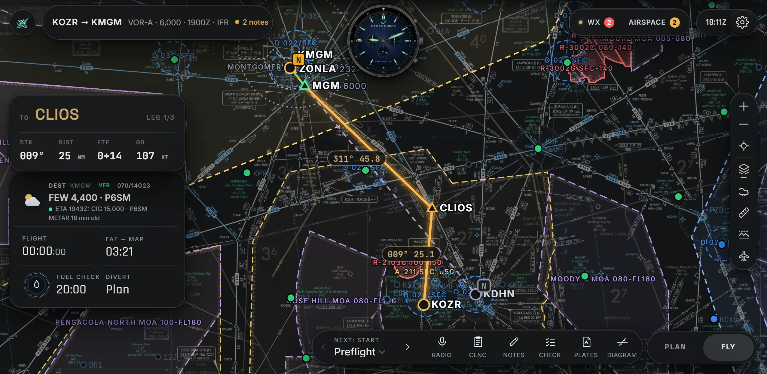
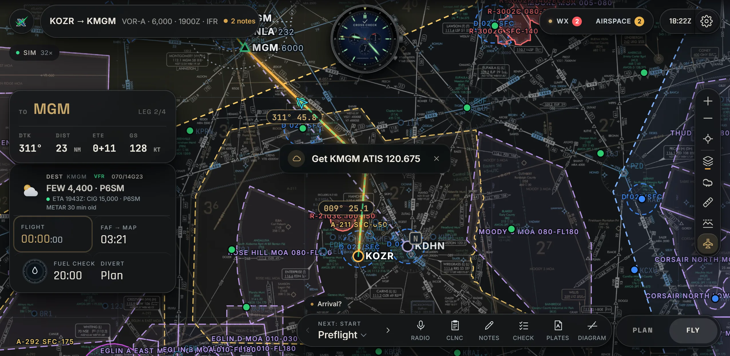
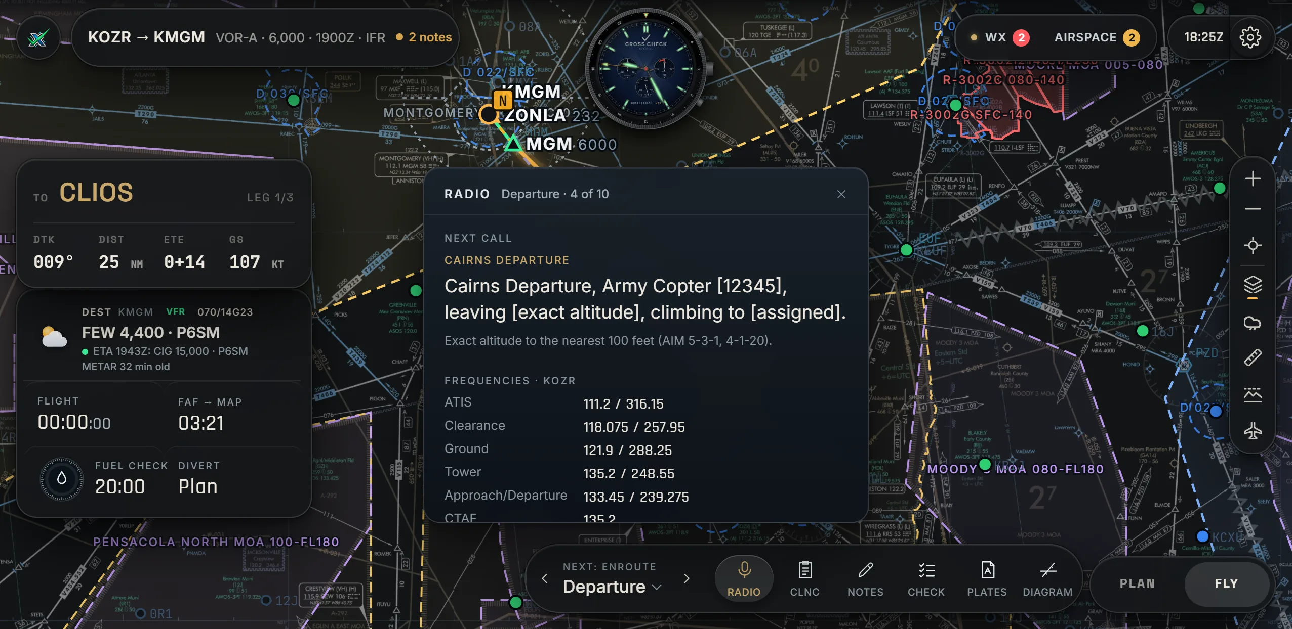
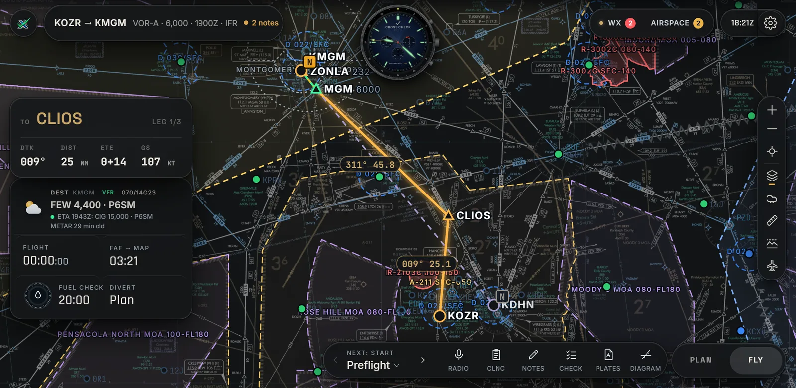
Cross Check in Fly mode: the route on the enroute chart, the leg card, destination weather and timers floating on the left, the chronograph at the top
Fly mode. The chart is the hero; your leg, the weather and the timers float beside it. Real app, live data.
VFR and IFRPlan either from the same planner, on the chart that fits.
Live weather and NOTAMsRead against your route, your times and your aircraft.
The rule, citedEvery answer shows the paragraph it came from.
One price. Every feature.Nothing held back for an upgrade.
Charts

Four charts. One tap.

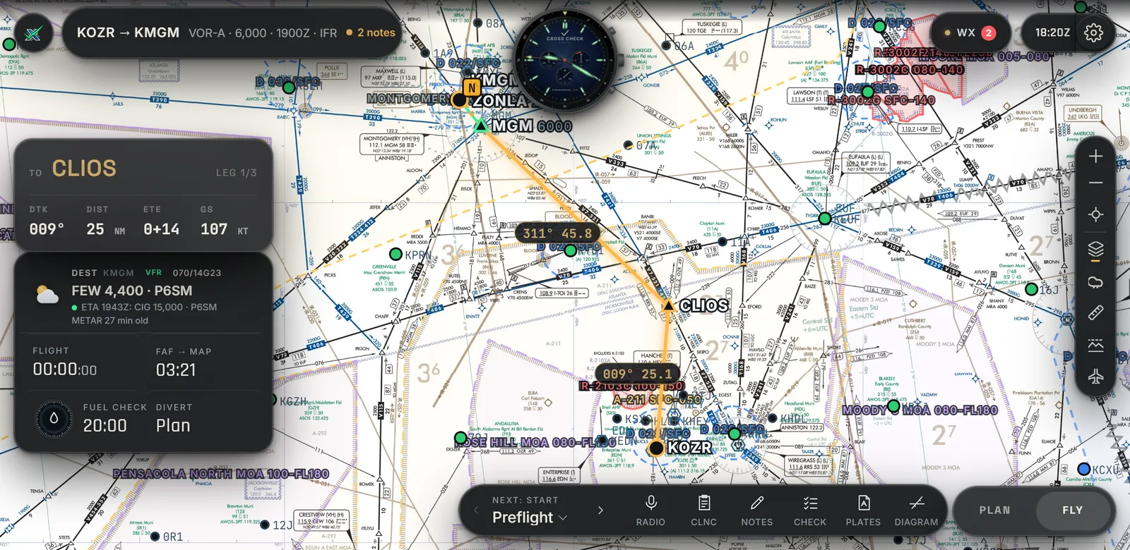
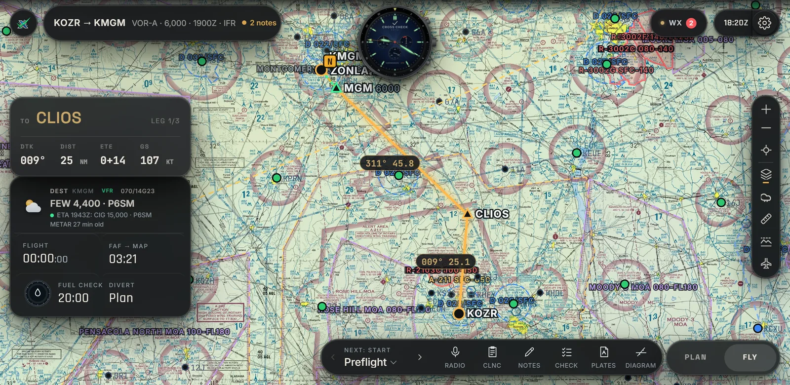
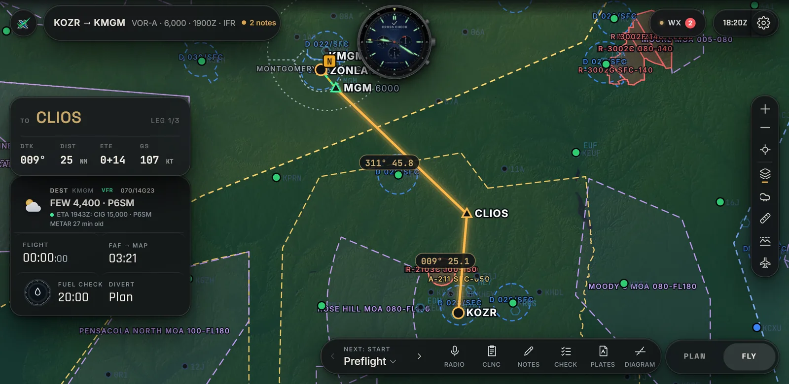
IFR enroute in charcoal or paper colors, the VFR sectional and shaded terrain, nationwide and current every cycle, with airspace in true color on all of them.

IFR enroute low chart in charcoal
IFR Enroute Low · CharcoalNight-friendly
IFR enroute low chart in paper colors
IFR Enroute Low · PaperThe chart as printed
VFR sectional chart
VFR Sectional1:500,000
Shaded terrain
TerrainShaded relief, elevation colors
One flight, start to finish

Less time assembling the flight. More time understanding it.

01 · PLAN

Plan it once.

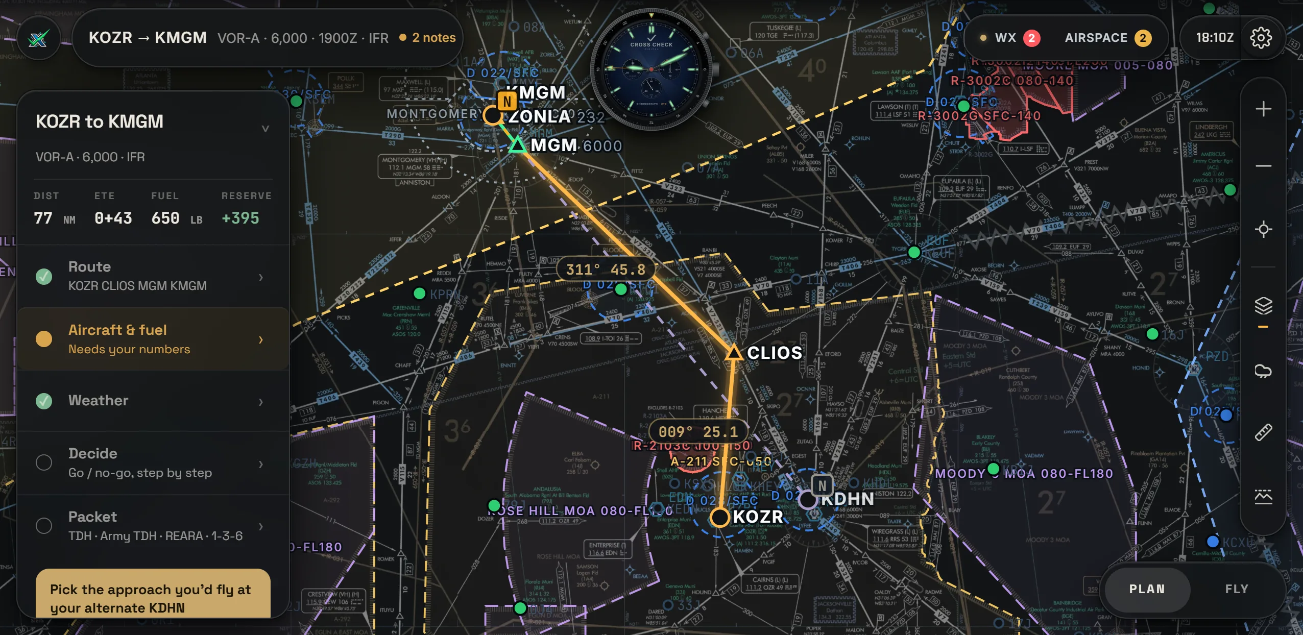
Departure, route, approach, alternate and altitude, on the real chart. One quiet card holds five steps, with a dot for whatever still needs you. Everything after this comes out of the one plan.

Plan mode: the route on the chart and the plan card with Route, Aircraft and fuel, Weather, Decide and Packet
02 · WEATHER

The weather for your times.

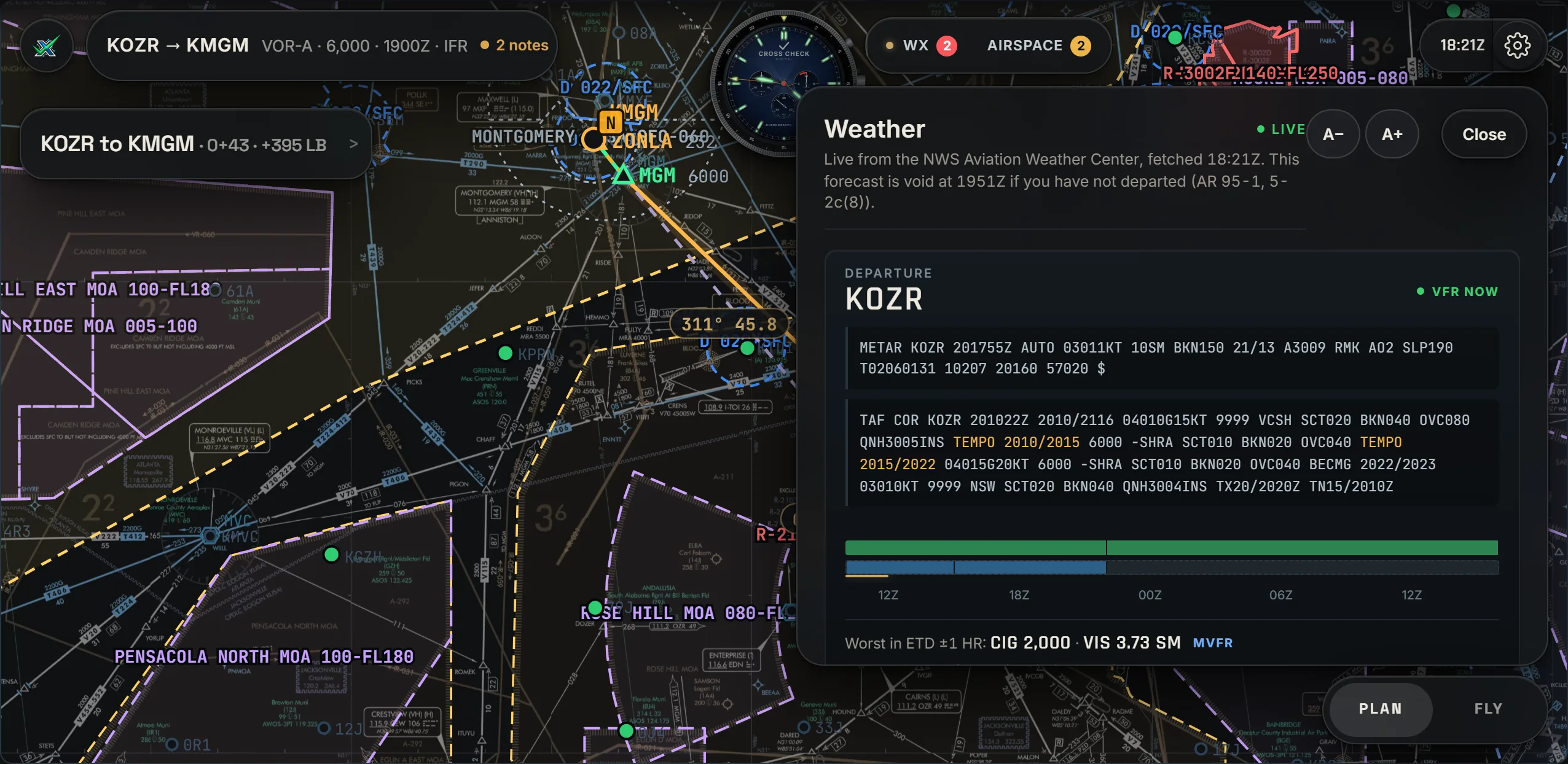
METARs and TAFs for every field on the plan, the worst conditions in your window drawn as a timeline, and the category called for you: VFR, MVFR, IFR or LIFR.

The Weather sheet: METAR, TAF and the forecast timeline for the departure field
03 · DECIDE

It tells you why.

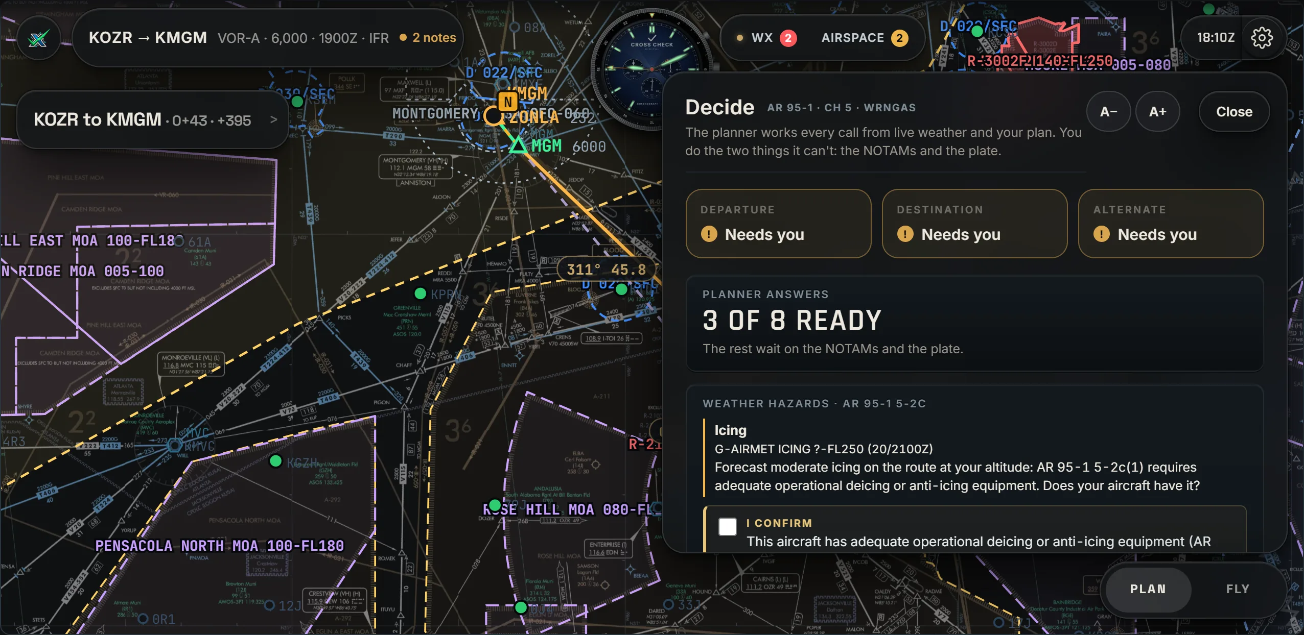
Can you take off? Is there a usable approach? Do you need an alternate, and is it legal? Is the fuel there? Each answer shows the rule it came from, so you learn why the plan works, not just that it does. You make the call, and it is recorded.

Decide: departure, destination and alternate, the planner's answers and the weather hazards with the rule cited
04 · NOTAMS

NOTAMs, read against your plan.

Every NOTAM for the fields, the approaches, the navaids and the route, sorted by what actually touches this flight, each with the reason. When the approach you planned is out of service, you see it before you taxi.

Decide: NO-GO because NOTAM MGM 11/103, KMGM ILS RWY 10 out of service, is the planned destination approach
05 · PAPERWORK

The paperwork comes out of the plan.

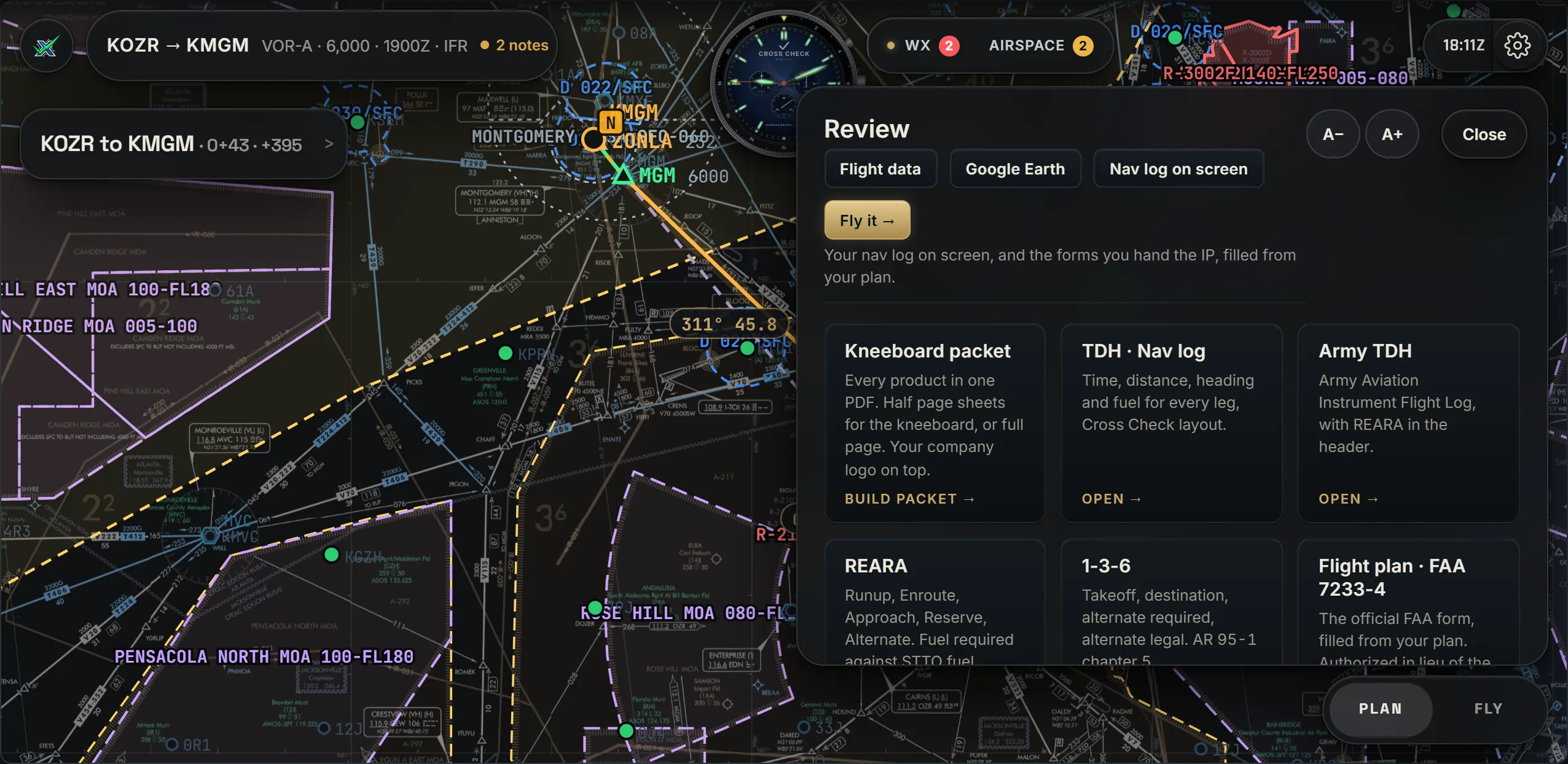
Nav log, fuel, flight plan and weather brief, filled from the plan you just built, then printed as one kneeboard packet.

TDH nav logArmy TDHREARA1-3-6FAA 7233-4DD 175-1Kneeboard packet
The Packet sheet: kneeboard packet, TDH nav log, Army TDH, REARA, 1-3-6 and the FAA flight plan
06 · FLY

Reminders before you need them.

Two minutes before each fix: the next course, the radial and the VOR to tune. Then the ATIS, the approach frequency, the FAF and the missed, each as it comes up. Every radio call is written out in your call sign, with the reference behind it.

A reminder in flight: Get KMGM ATIS 120.675
The Radio sheet: Cairns Departure, Army Copter, leaving exact altitude, climbing to assigned, with the AIM reference and the frequencies
07 · DIVERT

When the plan changes.

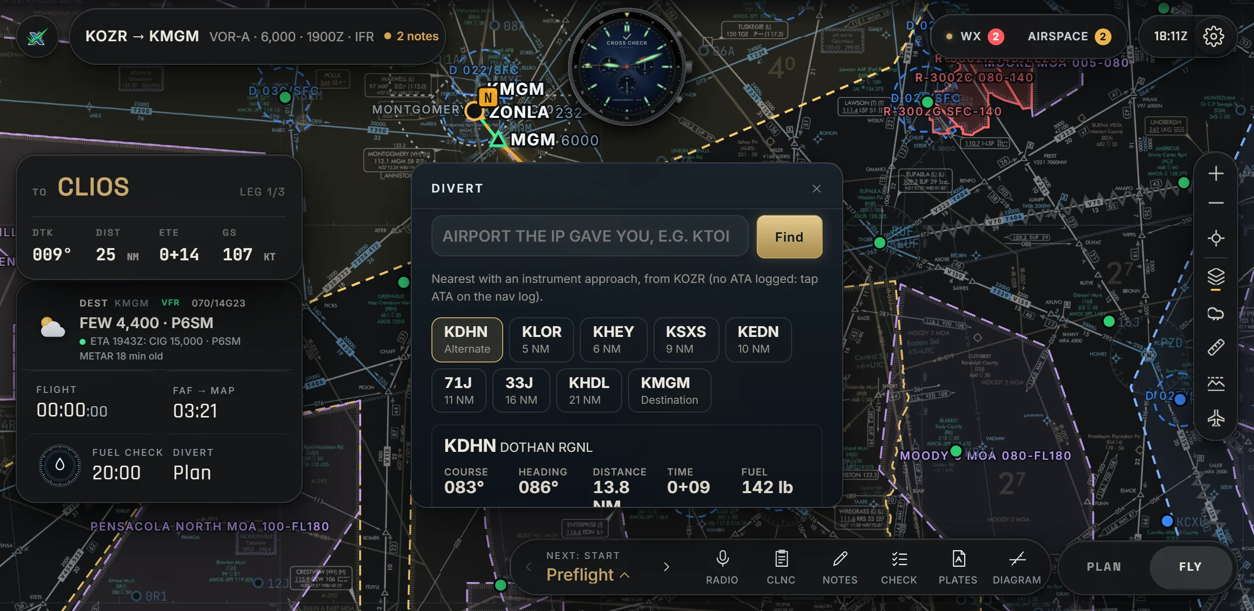
The nearest fields with an instrument approach: course, distance, time and fuel to each, the current weather, whether the field can take you, and the approach into the wind suggested. New approach from ATC? Two taps.

Divert: nearby fields with an approach, KDHN worked with course, heading, distance, time and fuel
One real example

A question, the answer, the reason, the form.

From one KOZR to KMGM flight, exactly as the app showed it.

  1. 01 · THE QUESTION

    Can I fly the approach I planned into KMGM?

    You planned the ILS Z RWY 10. Before you taxi, Decide checks it against every live NOTAM.

  2. 02 · THE ANSWER, WITH THE REASON

    No-go, and here is why.

    NOTAM MGM 11/103: the KMGM ILS RWY 10 is out of service, and your planned approach uses it. You find out at the planning table, not on final.

  3. 03 · THE RULE

    Every answer names its source.

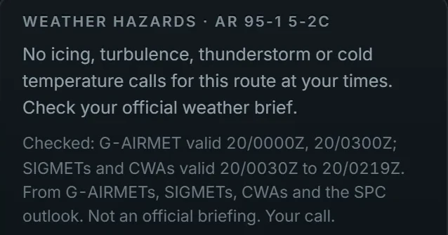
    Weather hazards are checked under AR 95-1, paragraph 5-2c, against the AIRMETs, SIGMETs and CWAs valid for your times, and it lists the ones it read.

    Weather hazards, AR 95-1 5-2c, with the advisories checked listed
  4. 04 · ON THE FORM

    Already on your flight log.

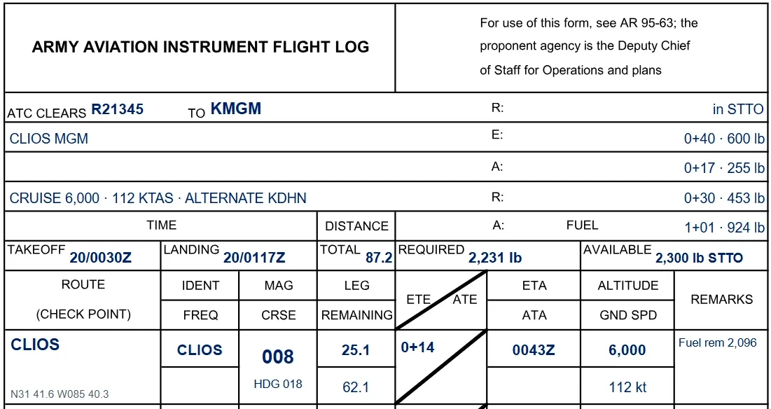
    Alternate KDHN, every leg, time and fuel: 2,231 lb required against 2,300 lb available, filled in on the Army instrument flight log, ready to print.

    The Army Aviation Instrument Flight Log filled from the plan, alternate KDHN, fuel required 2,231 lb, available 2,300 lb
Make it yours

Your route color. Your dial. Your layout.

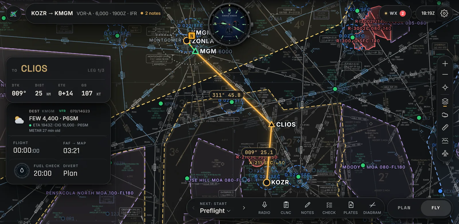
Five route colors, Red night included. Five chronograph dials with night lume. Touch and hold any card to move it where you like; the planner remembers it.

Fly mode with the Amber route color
The five chronograph dials: Black, Navy sunburst, Silver, Olive and Panda
Pricing

One price. Every feature.

Pick the edition for the rules you fly under and you get the whole planner, VFR and IFR. The editions differ in the rule set and the forms, not in features.

Army edition · BETA OPEN
$17.99 per month

For Army aviators, students and instructor pilots. Every call is worked under AR 95-1 and TC 3-04.5, and the plan fills the Army products: the TDH instrument flight log, REARA, the 1-3-6 and the DD 175-1, with Army call signs in every radio call.

Civil edition · COMING NEXT
$12.99 per month

For civil VFR and IFR pilots and students, airplane and helicopter. Every call is worked under 14 CFR 91 and the AIM, with the FAA flight plan. The same planner, without the Army layer.

Who built it

Two retired Army aviators.

We planned and flew with the same publications you use, and built the planner we wanted on our own kneeboard. You talk directly to the two aviators building it, and we answer every message ourselves. Every member can post on the Ideas board, and an idea that ships carries your name.

Darrell JordanManaging Member
Thomas Alan MooreMember
Ideas boardForum
Questions

Questions pilots ask

Who is it for?

VFR and instrument pilots, students and instructors. The Army edition is accepting beta testers now, starting at Fort Rucker. The civil edition, built on FAA rules, is next.

Does it do VFR?

Yes. Plan VFR or IFR from the same planner, with VFR weather and the sectional chart one tap away.

How does beta access work?

Fill in the form at the bottom of this page. We read every request ourselves and reply by email. If you are in, you get an invite email with your sign-in link.

What does it run on?

It's a website, best on an iPad in landscape. Plan on a laptop, then open the same plan on the iPad in the cockpit.

Is anything held back?

No. Every feature is in every plan. There are no tiers, no add-ons and no upsell.

Can I use it to navigate?

No. It's a training and planning aid. Always check official sources, and the pilot in command makes every decision.

Army edition · Beta

Plan it. Brief it. Fly it.

Request beta access. We read every request ourselves and reply by email. If you are in, your invite arrives with a sign-in link.